Rs.8,499/
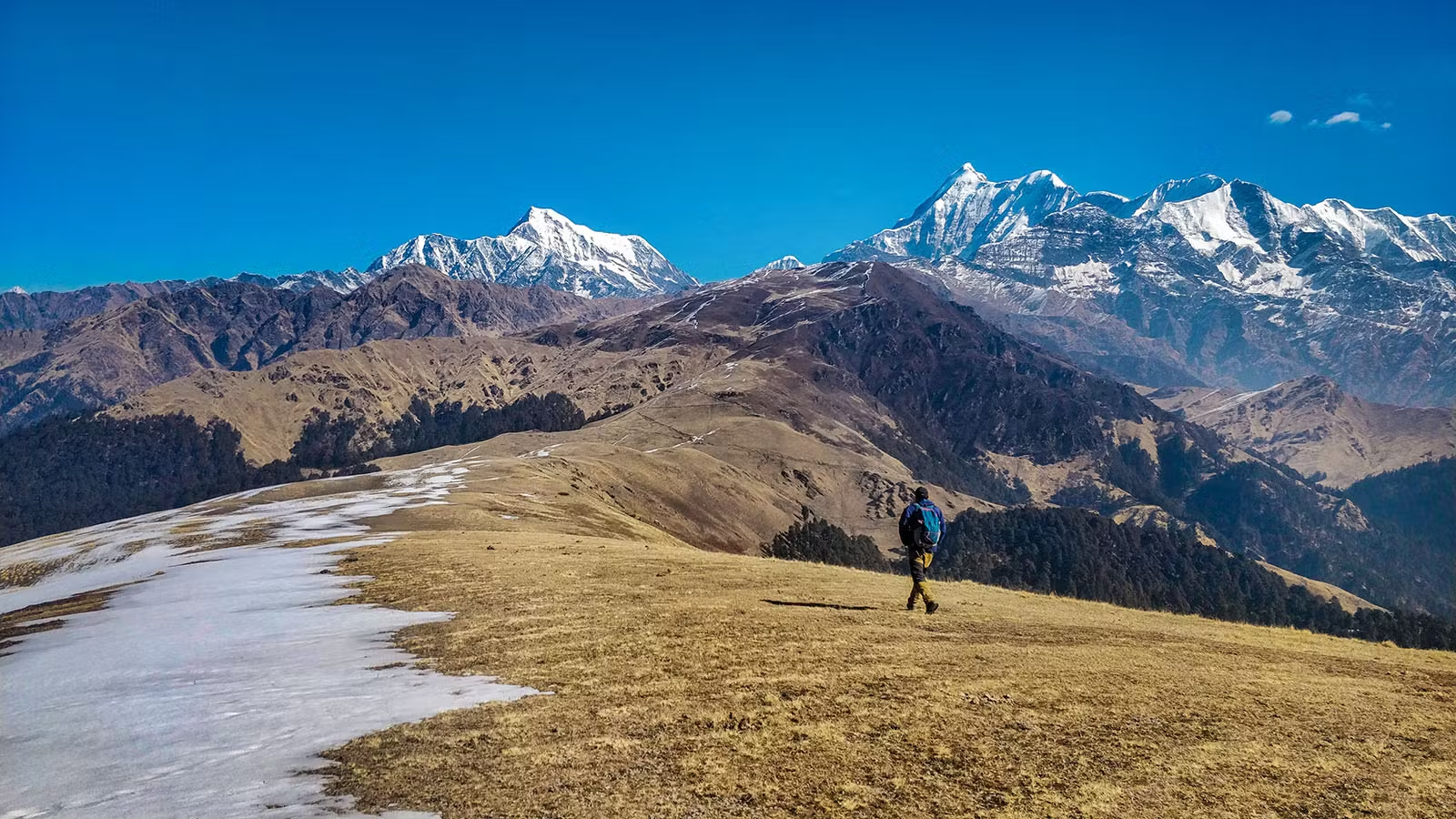
Per PersonSuppose you’re in search of a unique and exclusive mountain experience. In that case, Xplorethedream is delighted to offer you the opportunity to join our Ali Bedni Bugyal Trek in Uttarakhand. This trek is a rare combination of breathtaking views of snow-capped peaks and beautiful meadows, with Ali Bedni Bugyal standing out as one of the top alpine meadows in the nation. Ali Bugyal and its neighbour, Bedni Bugyal, are not just expansive, but also exclusive, being amongst Asia’s most expansive meadows at high altitudes. The beauty of these alpine meadows, coupled with the exclusivity of this trek, makes it an unforgettable adventure for both beginners and experienced hikers. Prepare to be privileged with the most breathtaking snow-capped mountain views in the region, with Mt. Trishul Parvat and Nanda Ghunti rising to 6000-7000 feet before you.
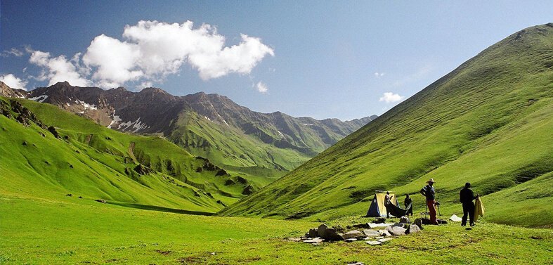
Ali Bedni Bugyal is a must-visit spot for those who love nature and Adventure and are passionate about photography. The trek will take you through beautiful valleys, quiet hamlets, deep dark forests, and stunning flowers. This trek heals and rejuvenates one’s body, soul, and mind. It’s an unforgettable experience that will be remembered for years to come. Many wildflowers bloom here in summer, contributing to the meadow’s beauty. This meadow is a beautiful place to view the sunset, too. You can even observe the sun setting behind the peaks covered with snow in this region, making the view even more beautiful. The meadows also house numerous species of animals and birds, such as a herd of musk deer that can be seen enjoying a romp in the lush greenery. The ideal season in Ali Bedni Bugyal can be in the summertime when meadows are in peak bloom and when the views of the mountains are at their finest. However, the meadows are accessible and appealing all through the year.
Included and Excluded
- Stay: 2 Nights will be in a hotel or guest house on a multi-sharing basis, and 3 Nights of tented accommodation at individual campsites of Xplorethedream on twin sharing.
- Meals: Xplorethedream will provide freshly cooked meals during the trek starting with Dinner on Day 1 to tea, coffee on day 6 (Meals are simple, nutritious, and vegetarian)
- Transport Optional: Rishikesh to Rishikesh and return. ( 1600 extra )
- Trek Insurance Mandatory: (Xplorethedream recommends each trekker to get insurance)
- Trek Equipment: Sleeping bag, Sleeping tents, Kitchen tent, Dining tent, Toilet Tent.
- Amenities: All utensils, sleeping mattresses (Black foam mats), Crampons, and Gaiters for snow.
- Health & Safety: First Aid Box, Oxygen Cylinders, Stretchers, Oxi meters, BP Machines, health.
- Permits: Forest Permits and Camping Permission Fee
- Trek Crew: High Altitude Chef, Helpers, Trek Leader & Guides, and other support teams.
- Potters & Mules: Potters and Mules are to carry all trekking equipment, ration, and vegetables.
- GST 5% (it is Mandatory)
- Any Meals/accommodation beside the itinerary or not mentioned in the program.
- Any Bus / Airfare to/from trek start/end point
- Personal Medical expenses do carry your medication.
- Any personal services such as Laundry, phone calls, liquors, mineral water, etc.
- Any still / video camera fee
- Any Entrance fee Monuments, Monasteries, Museums, Temples – Pay directly on the spot.
- Mules or porter charges to carry private baggage (Offload Charges for bag 400 per day, per bag if paid online (at base camp 2,000). Note: Bag weight should not be more than 10 kg.
- Any emergency evacuation charges
- Any services that are not mentioned in the cost inclusion section.
Highlights of the Tour
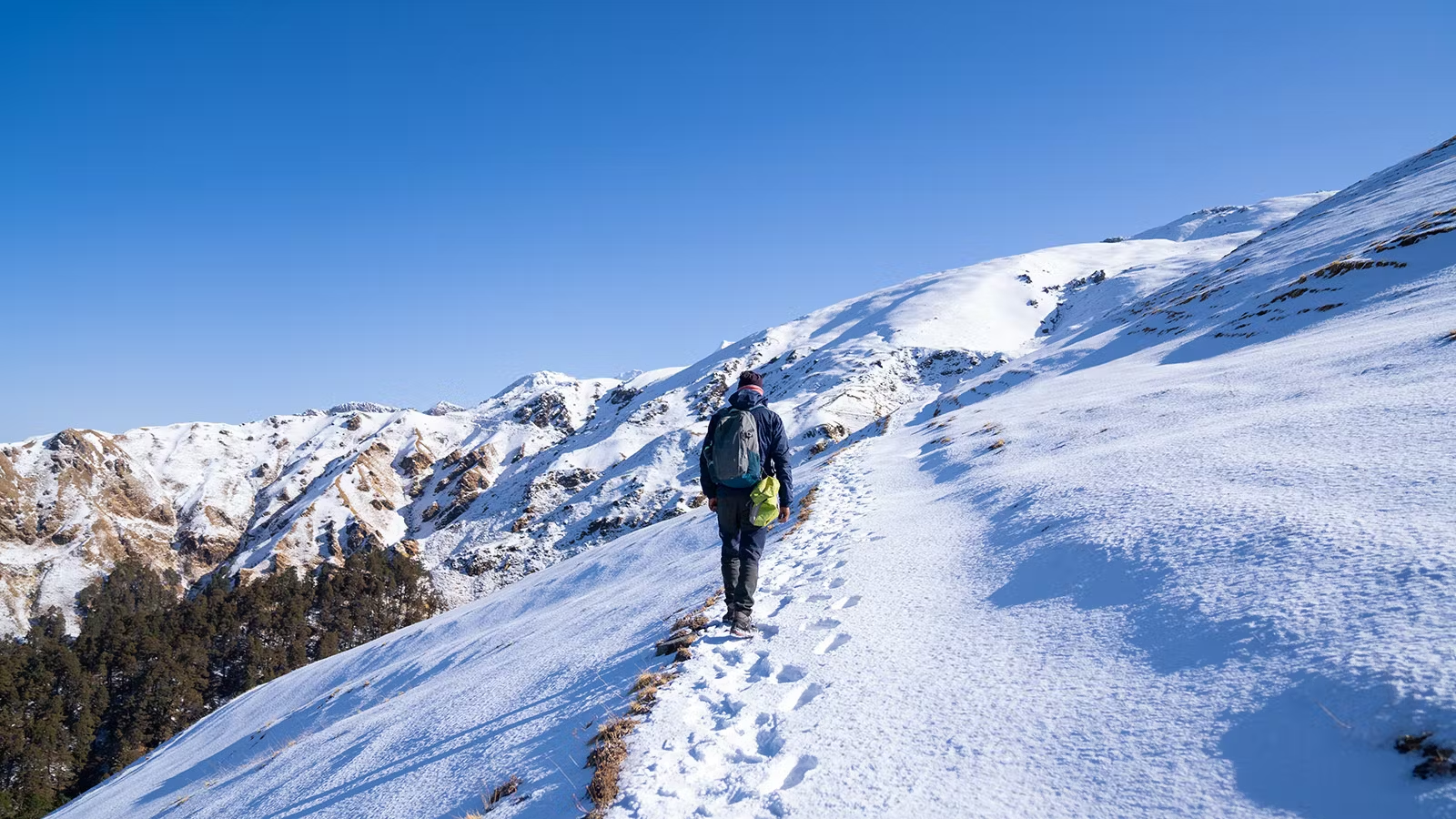
- Year-round accessibility offering lush greenery or snow-laden trails depending on the season.
- 360-degree panoramic views of the mighty Himalayan peaks
- A trek suitable for all age groups with minimal fitness requirements.
- A serene summit offering complete peace and spectacular mountain experiences.
Itinerary
Driving Distance: 261 Kms Driving Time: Approx 7-8 Hrs Pickup Location: Natraj Chowk, Rishikesh Pickup Time: 0630 Hrs Overnight stay In Guest House Overnight stay in Guest House Meal Dinner Only Today morning met a Xplorethedream representative/driver at Natraj Chowk, Rishikesh, in the morning at 0630 Am. After that, we drive through a scenic route that passes through winding roads and forests, offering views of the majestic Garhwal Himalayas, enroute we will stop for Breakfast and Lunch at a local restaurant with direct payment. Along the way, you will cross three major holy confluences of Devprayag, Rudraprayag, and Karanpryag. On a clear day, you can see the Garhwal Himalayan ranges in the distance. Reaching our destination, Lohajung, in the evening hours. The small village of Lohajung is home to some of the most beautiful scenery in the country. Its name is rooted in a local legend that tells of Goddess Parvati killing a demon called Lohasur here. Lohajung offers an enchanting escape with breathtaking views of the mountains. It is also a base camp for exploring the high-altitude Roopkund Trek, which is a must-do during your stay in this part of Uttarakhand. On arrival, check into the booked accommodation, meet and interact with our team members, and be ready for the trek briefing, followed by dinner and good night sleep.
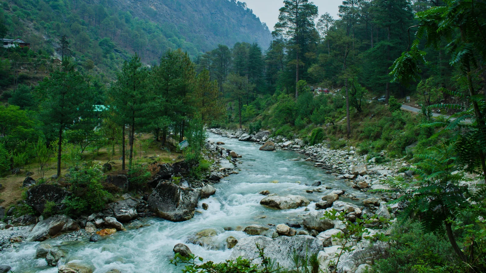
Trek Distance: 7 Kms Time taken: Approx 5-6 Hrs Altitude Gain: Approx 550 Feet Overnight in Trekking tents Meal Breakfast / Lunch / Snacks and Dinner Only Overnight stay in Camps Morning enjoy breakfast at Xplorethedream Guest House and get ready for 1st day trek from Lohajung to Didna with Xplorethedream experts. The trail starts close to the Lohajung bus stop, is a trail that will take the trekkers through Raun Bagad, an iron bridge situated just under Didna village. As we walk towards Raun Bagad, we will be amazed to hear the thrushes’ whistles and the soft chirps from the swallows as they flit among the Rhododendrons. Below wan river flows to join with the Bedni Ganga and then, seemingly from the depths of the water, one can spot Lammergeiers with their huge wings spread out to catch the eddies. If you’ve chosen the highway, Kulling village springs out upon you at a trough (6 kilometres far from Lohajung). Kulling is a group of around 20 houses placed against the emerald green of the stepped hills. In the direction of Kulling village, it’s quite a steep climb down to Wan river. The elevation drops, and you’re not happy about it, but you are aware that eventually, you’ll have to retrace the lost height on the opposite bank. If you’ve walked the path traversing the forest, you’ll find an easy descent down into the river, and you won’t even notice it. After two hours of Lohajung, you will reach an iron bridge crossing the river. It can be described as Raun Bagad, a grassy bank that runs along the river. It is the best site to pitch tents here. Take note of this if you get to Lohajung early and search for a site that gives you an advantage. After crossing river, the trail becomes steeper. It’s a zig-zag up to Didna. The climb is easy, but your legs can tire easily. By breathing fast, you’ll get to Didna in just one hour and a half. Didna village is hazy as numerous trails connect to it. Follow the trails that run around the village’s edge and direct you to the Didna campsite, which is approx 200 feet higher than the village.
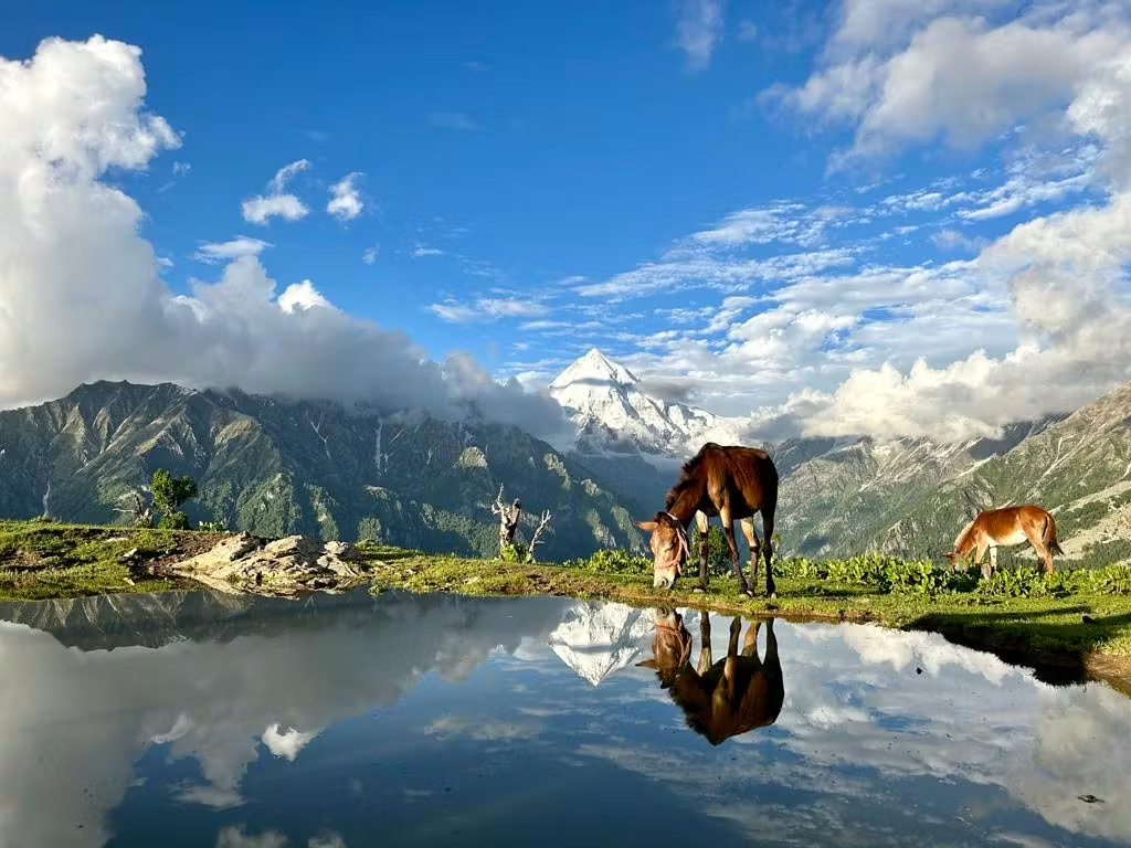
Trek Distance: 9 Kms Time taken: Approx 6-7 Hrs Altitude Gain: Approx 3050 Feet Overnight in Trekking tents Meal Breakfast / Lunch / Snacks and Dinner Only Overnight stay in Camps Meal Breakfast / Lunch / Snacks and Dinner Only Overnight stay in Camps Day Wise Detailed Itinerary of Ali Bedni Bugyal Trek Day 01: Rishikesh - Lohajung by surface 261 Kms approx 7-8 Hrs Driving Distance: 261 Kms Driving Time: Approx 7-8 Hrs Pickup Location: Natraj Chowk, Rishikesh Pickup Time: 0630 Hrs Overnight stay In Guest House Overnight stay in Guest House Meal Dinner Only Today morning met a Xplorethedream representative/driver at Natraj Chowk, Rishikesh, in the morning at 0630 Am. After that, we drive through a scenic route that passes through winding roads and forests, offering views of the majestic Garhwal Himalayas, enroute we will stop for Breakfast and Lunch at a local restaurant with direct payment. Along the way, you will cross three major holy confluences of Devprayag, Rudraprayag, and Karanpryag. On a clear day, you can see the Garhwal Himalayan ranges in the distance. Reaching our destination, Lohajung, in the evening hours. The small village of Lohajung is home to some of the most beautiful scenery in the country. Its name is rooted in a local legend that tells of Goddess Parvati killing a demon called Lohasur here. Lohajung offers an enchanting escape with breathtaking views of the mountains. It is also a base camp for exploring the high-altitude Roopkund Trek, which is a must-do during your stay in this part of Uttarakhand. On arrival, check into the booked accommodation, meet and interact with our team members, and be ready for the trek briefing, followed by dinner and good night sleep. Day 02: To Didna From Lohajung By Trek Trek Distance: 7 Kms Time taken: Approx 5-6 Hrs Altitude Gain: Approx 550 Feet Overnight in Trekking tents Meal Breakfast / Lunch / Snacks and Dinner Only Overnight stay in Camps Morning enjoy breakfast at Xplorethedream Guest House and get ready for 1st day trek from Lohajung to Didna with Xplorethedream experts. The trail starts close to the Lohajung bus stop, is a trail that will take the trekkers through Raun Bagad, an iron bridge situated just under Didna village. As we walk towards Raun Bagad, we will be amazed to hear the thrushes’ whistles and the soft chirps from the swallows as they flit among the Rhododendrons. Below wan river flows to join with the Bedni Ganga and then, seemingly from the depths of the water, one can spot Lammergeiers with their huge wings spread out to catch the eddies. If you’ve chosen the highway, Kulling village springs out upon you at a trough (6 kilometres far from Lohajung). Kulling is a group of around 20 houses placed against the emerald green of the stepped hills. In the direction of Kulling village, it’s quite a steep climb down to Wan river. The elevation drops, and you’re not happy about it, but you are aware that eventually, you’ll have to retrace the lost height on the opposite bank. If you’ve walked the path traversing the forest, you’ll find an easy descent down into the river, and you won’t even notice it. After two hours of Lohajung, you will reach an iron bridge crossing the river. It can be described as Raun Bagad, a grassy bank that runs along the river. It is the best site to pitch tents here. Take note of this if you get to Lohajung early and search for a site that gives you an advantage. After crossing river, the trail becomes steeper. It’s a zig-zag up to Didna. The climb is easy, but your legs can tire easily. By breathing fast, you’ll get to Didna in just one hour and a half. Didna village is hazy as numerous trails connect to it. Follow the trails that run around the village’s edge and direct you to the Didna campsite, which is approx 200 feet higher than the village. Day 03: By Trek to Khobal from Didna via Ali Bugyal Trek Distance: 9 Kms Time taken: Approx 6-7 Hrs Altitude Gain: Approx 3050 Feet Overnight in Trekking tents Meal Breakfast / Lunch / Snacks and Dinner Only Overnight stay in Camps Meal Breakfast / Lunch / Snacks and Dinner Only Overnight stay in Camps The hike today will take you through the picturesque community that is Ali Bugyal. The town lies at an elevation of 3400m (11000 feet). The village’s imposing location is at the top of the mountain and is visible from Didna, the last camping spot. Therefore, the hike is up to the top of the hill and Ali Bugyal, which starts from the village. You’ll see huge groups of sheep brought here for grazing by local shepherds from nearby villages. If you’re not aware, most hikes are paths used by the shepherds they use to feed their livestock. Shepherds are very friendly and willing to share their stories. They say that the mountains are adorned with rhododendrons in spring. There is also oak and Birch trees along the slope. These trees add a lot of energy to the trip. It can be seen as the greenest thing you can see with your viewers as the trees slowly start to disappear as you get closer to the top. It’s a climb that takes 3-4 hours, and Ali Bugyal, the most awaited attraction, is waiting to welcome you. The meadows are the most attractive scene you’ve seen in your life. Each painful experience is worth it when you walk in the meadows. If you’re lucky, a few horses are grazing in the region. The green grasses are blue with white Himalayan mountains in the background. The highest mountain in the sky will appear to be Trishul mountain. While you take in the views, the camping area is distant. There’s still a walk of about 30 minutes to lead to Bedni. It will be our campsite in the evening. Relax and enjoy in the Bedni Kund. Explore the temple and take a rest in the tents.
Trek Distance: 7 Kms Time taken: Approx 6-7 Hrs Altitude: Gain at Bedni Bugyal and Loss at Camp site Overnight in Trekking tents Meal Breakfast / Lunch / Snacks and Dinner Only Overnight stay in Camps Today, we will pass through the second portion of Bugyal, Bedni meadows. The meadows are incredibly lush, with stunning Himalayan mountains in the background. The meadows are adorned with vibrant flowers during the summertime. It makes them the preferred destination of a lot of tourists. The attraction isn’t just the grasslands; Bedni Kund is also beautiful. Be sure to capture those reflections from the hills on the lake. Enjoy a relaxing afternoon while enjoying the hot meal packed in the grasslands. After a vigorous break, go to Ghairoli Patal via the downhill route. The route passes through a tall forest filled with flora and fauna. Make sure not to speed and crash over. The grassy area between thick forest and open space is Ghairoli Patal.
Trek Distance: 7 Kms Time taken: Approx 5-6 Hrs Altitude Gain: Approx 2750 Feet Driving distance Wan – Lohajung Driving distance 30 Kms approx 45 Minutes Overnight in Trekking tents Meal Breakfast / Lunch / Snacks and Dinner Only Overnight stay in Camps From Gehroli to Gehroli, a ridge climbs towards its Neel Ganga River. The most fast-paced trekkers can reach the river within one and one-half hours. For slower trekkers, it takes two hours. Be patient because you’ll rarely see a more stunning section of forest. The bridge along the Neel Ganga is a perfect spot to cleanse the dirt and grime from the long hike. Trees encircle the river, the water courses, and fall over rocks under shade. The water is refreshing and cool. Once you are in the river, it’s only a one-hour climb to the ridge above Wan village. A variety of routes lead to the base of Wan village. All roads ultimately lead towards the junction of roads (Kasar Bagad) close to the hydroelectric project. It takes approximately one hour and a half to descend to Kasar Bagad. It’s a long and steep climb. There’s an alternative route to descend to Wan. You can take the main trail to the left from the top of the ridge in Wan. Continue following the path until it comes to the Cyprus trees located at the bottom of Wan village. You should look at the Cyprus trees as they’re thousands of years old! It’s a jeep ride to go from Wan up to Lohajung. It’s approximately 45 minutes.
No Accommodation Meal Breakfast Only It’s the final day of the trek, and it’s time to return to your beautiful home. You’ll rise early and enjoy your final breakfast on the hills. After you board the pickup vehicle, you will reach Rishikesh and complete the long journey.
Location Map
Frequently Asked & Question
Book Your Tour
Reserve your ideal trip early for a hassle-free trip; secure comfort and convenience!







Leave a comment: