Rs.8,999/
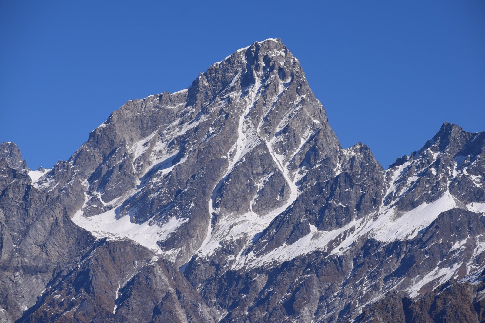
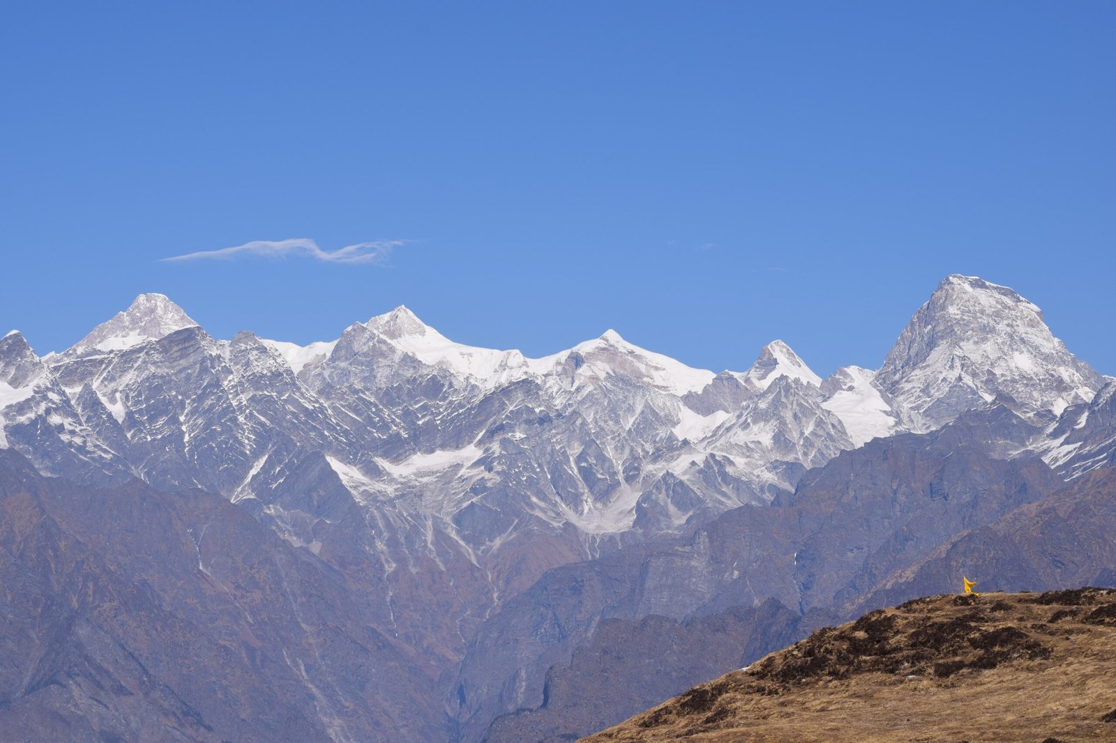
Per PersonWhether you are an experienced trekker or a beginner, the Kuari Pass Trek is a trek you must do. It’s a must to see the stunning views of India’s most famous mountains, including Mt. Nanda Devi (25,673 feet) and Mt. Dronagiri (23,182 feet) In any season. Of the numerous things Lord Curzon accomplished in India, the most popular is the exploration and propagation of a trek route beginning at Joshimath through Kuari Pass in the Garhwal Himalayas. At 4264m, Kuari Top is like an arena, where the Himalayan mountains that have stood the test of time play their part. The 7000m club comprises Kamet (7756m), Trishul (7120m), Chaukhamba (71 Kamet (7756m), Trishul (7120m), Chaukhamba (7128m) and the fantastic majestic mountain that is Nanda Devi (7817m) and its twin Nanda Devi East (7434m). More peaks appear impressive: Nanda Ghunti, Hathi Ghoda Parbat, Neelkanth, Dronagiri, Mukut Parbat, Mana, Rishi Pahad, and Changbang, among others. Kuari Pass Trek, Kuari Pass Trek, allows you to see this stunning mountain range from a close-up.
In winter, there’s an additional reason to visit. While most other mountain passes within the Himalayas are covered with snow, the Kuari Pass is only an accessible mountain pass during the winter. While you aren’t traditionally crossing the pass, you walk to the pass to take in the breathtaking views from the top.
The Kuari Pass trek begins at Joshimath within the Chamoli district of the Himalayas, which has grown into the leading destination for trekkers and pilgrims from this part of the Himalayas. To start, Kuari Pass is a four-day trek (6 days when you count the days of travel from Rishikesh to Joshimath and Return). Visit famous pilgrim cities like Rishikesh, Devprayag, Joshimath and Haridwar. The Kuari Pass trek within the Garhwal Himalaya is 31 km long. It is well-known for its ability to look out over India’s second-highest peak, Mount Nanda Devi.
The Kuari Pass trek at an altitude of 12,516 feet. Provides you with views from the summit of Dronagiri, Chitrakantha, Chaukhamba and Tali High. The Interlude of meadows and beautiful forests bursting with rhododendrons and oak trees makes your trek more attractive. On the way, you will also enjoy the breathtaking sights of the holy rivers like Bhagirathi and Alakananda, making the climb more thrilling.
Differently, snow can be an experience all on its own in this hike. The snowy floor of this perfectly crafted forest and snowflakes settling upon the Oak leaves, an un-smooth carpet will take you straight to the landscape that would be Santa’s admiration.
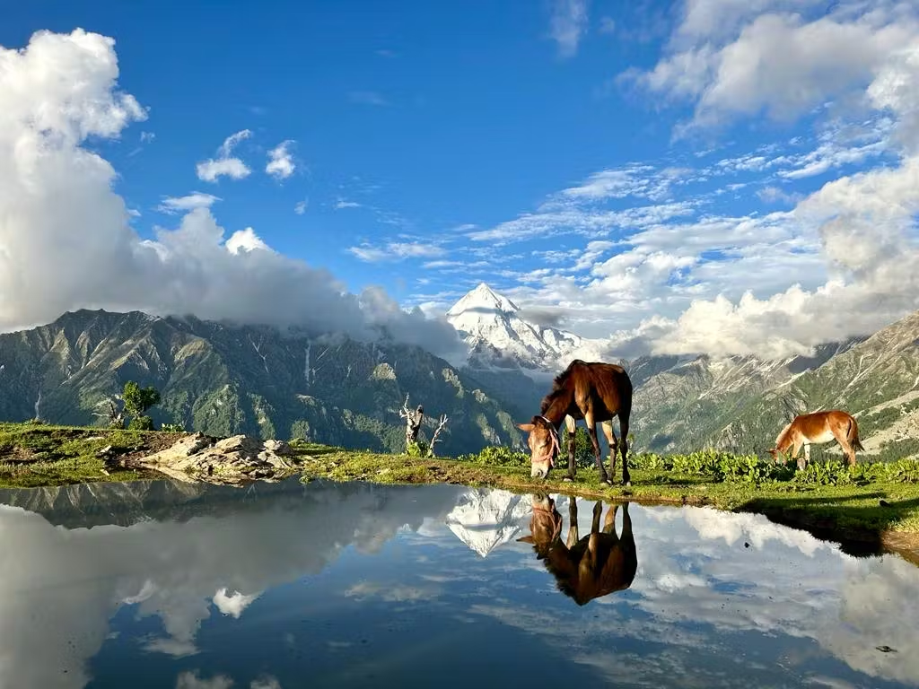
The most refreshing aspect of the trek is traversing the gorgeous Himalayan meadows. They are referred to as “Bugyals” in the local language. It would help if you did not skip over the serenity and beauty of the Himalayan meadow. The most impressive is Gorson Bugyal, consisting of vast green pastures that undulate. Along this trek, you’ll also be able to visit Auli, famous for its gorgeous ski slopes during winter.
Kuari Pass is an easy-moderate trek that is simple enough for anyone who wants to start on the Himalayas.
The trek will take you through several lesser passes, including the Vinayak Pass and Tali Top. They eventually lead you to the trek’s highest point, the Kuari Top, which is 13990 feet. The trek is simple and will pay enormous dividends for your physical exertion, with stunning views of the most beautiful mountains of the Himalayan Range. The spectacular view of the Nanda Devi Massif is the main attraction of this trek. So, if you’re looking to spend some time in the meadows or the snowy slopes of the Garhwal Himalayas, then pack your backpacks and set off toward Haridwar. Xplorethedream will take you along the Curzon Trail through Kuari Pass while you enjoy the stunning views.
Included and Excluded
- Stay: 3 Nights of tented accommodation at individual campsites of Xplorethedream on twin sharing and 2 nights at Xplorethedream guest house at Joshimath on multi sharing.
- Meals: Xplorethedream will provide freshly cooked meals during the trek starting with Dinner on Day 1 to tea, coffee on day 6 (Meals are simple, nutritious, and vegetarian)
- Transport (Optional): Rishikesh to Joshimath and return. ( 1600 extra )
- Trek Insurance (Optional): Xplorethedream recommends that all trekkers consider getting trek insurance. This is optional, but highly recommended. Trek insurance covers unexpected events that may occur during your trek. The cost of the insurance starts from INR 210.
- Trek Equipment: Sleeping bag, Sleeping tents, Kitchen tent, Dining tent, Toilet Tent.
- Amenities: All utensils, sleeping mattresses (Black foam mats), Crampons, and Gaiters for snow.
- Health & Safety: First Aid Box, Oxygen Cylinders, Stretchers, Oxi meters, BP Machines, health.
- Permits: Forest Permits and Camping Permission Fee
- Trek Crew: High Altitude Chef, Helpers, Trek Leader & Guides, and other support teams.
- Potters & Mules: Potters and Mules are to carry all trekking equipment, ration, and vegetables.
- GST 5% (it is Mandatory)
- Any Meals/accommodation beside the itinerary or not mentioned in the program.
- Any Bus / Airfare to/from trek start/end point
- Personal Medical expenses do carry your medication.
- Any personal services such as Laundry, phone calls, liquors, mineral water, etc.
- Any still / video camera fee
- Any Entrance fee Monuments, Monasteries, Museums, Temples – Pay directly on the spot.
- Mules or porter charges to carry private baggage (Offload Charges for bag 400 per day / per bag if paid online (at base camp 2,200). Note: Bag weight should not be more than 10 kg.
- Any emergency evacuation charges
- Any services that are not mentioned in the cost inclusion section.
Highlights of the Tour
- Follow the historic trail of Lord Curzon, dating back to 1905.
- Witness panoramic views of Uttarakhand's major Himalayan peaks, including India's 2nd and 3rd highest peaks.
- Enjoy a scenic trek with stunning campsites amidst the Himalayas.
- Explore charming old villages in the Joshimath region.
- Experience accessible snow trails year-round, making it ideal for both beginners and experienced trekkers.
Itinerary
Altitude: 2,050m/6,750ft A 256-km drive that takes about 10 hours The trekkers are picked up up from Rishikesh by 6:30 AM. an Bolero or comparable car (cost includes) You can have breakfast and Lunch along the way (exclusive of cost) It’s a long trip from Rishikesh to Joshimath on the way. During the journey, you’ll see a variety of stunning views of the various cities that will pass by your route. The trek starts from Rishikesh. The pick-up location will be the Rishikesh, and we will then travel through Badrinath Road. If you’re passionate about the culture of sightseeing and adventure water sports, then you may want to plan a short stay in Rishikesh before your trek or after your trek. The 10-hour drive to Joshimath is bound to be lengthy and exhausting. However, you will never get bored with the breathtaking views. The magnificent river that flows with us in parallel will become more thrilling and wilder as we climb upwards. We’ll be passing through panchprayag. panchprayag also known as the 5 holy confluences in Ganga-Devaprayag, Rudraprayag, Karnaprayag, Nandaprayag and Vishnuprayag. Keep your cameras at hand and stay awake throughout the trip.
Altitude: 2,900m/9,600ft The route will take you to Joshimath up to Dhak village, which is 12km drive(2,050m/6750ft) The trail is made up of gradual and steep ascents and passes in the midst of villages. Enjoy the delicious hot Lunch at the campsite You’ll be able to see some of the stunning mountain ranges Dronagri, HathiParvat, and GoriParvat The trek will begin starting from Dhak village and continue to Gulling top campsite, which is 5 km of trek. The trek will provide stunning views of the peaks as well as grasslands and more while you hike. Stay the night in tents on twin sharing. A series of ice-capped mountains will greet us in Joshimath, which will appear more welcoming today than in the dawn of our journey to our base camp the first day. After breakfast, which is early this day, we’ll take off for Dhak village, located in the Joshimath Tehsil, which is a rough journey of about 45 minutes. From here, our trekking will begin. Be on the lookout towards the gentle slopes that make up The Sleeping Lady Mountain of Joshimath during this trek. The gentle slopes appear to create an outline of a sleeping lady. The trek begins starting from Dhak with a steady ascent. The dirt path diverges from the road and climbs toward Tugasi village. There are a few abrupt T-turns along this trail. After that, the walk begins on flat ground, followed by slowly rising slopes gently. The terrain is generally rough in this area. In the area left of the terrace farms, there is not a lot of greenery. However, it offers a panoramic panorama across the Garhwal frontier in all directions. Be on the lookout for the shining silvery sun-dazed stream of Dhauli-Ganga, which is snaking into the abyss. Also, look out for the Hydroelectric Vishnugad Tapovan Power Station. You won’t discover any snow in the area. About twenty to twenty-five minutes into the hike, it will take you to Kharchi village. You will get your bottles filled and take some time for yourself. The trail continues from Kharchi on the same rough path with the valley extending towards the right. The climb is steep and includes some switchbacks until it reaches the Lower Tugasi region. The trail is split in two, and you must choose the one that runs along with a hydro-powered flour mill. Within 10 minutes, you’ll reach an area known as the Upper Tugasi region, marked with flower beds, wheat fields and thatched roofed houses. There are also a few streams flowing through the region. Follow this route with a steady climb leaving the farmland to the left, and you’ll be greeted by the breathtaking view of Dronagiri mountain rising in terror from an infinity. We will pitch tents in open meadows with ideas of Dronagiri and surrounded by oak forest. You may request your trek leader to guide the group on a hike up to Gulling Top point this afternoon to experience the snow-covered forests on your own. Prepare yourself for the most stunning views that stretch across the Dronagiri peak that is caught by the glimmering dawn light that emanates from this campsite at dawn the next day.
Altitude: 3,350m/11,000ft 5.5 km, which is approximately 5 hours A hike will take you up the steep climb through rhododendron, oak (mostly white and pink) and walnut forests. You’ll be amazed when you experience the stunning beauty of this dark forest and nature trails Take advantage of the delicious lunch served on the campsite. Staying in tents for the night. Make sure you wake up on time the next morning to begin the 5 hour trek into the forests of Talli. After the arduous climb of the previous days, the climb today will be easier. The ascent slope are fairly smooth and give you a pleasant walk. About 20 minutes into the hike and you’ll arrive at an open green area that overlooks the majestic snow-capped mountains. After a short period of rest, you will need to continue, crossing a small stream, before you enter an ever-growing mixed forest that is slowly growing with rhododendrons, oaks, and rho. If you’re visiting to the area in late March, you may have a few white and pink blooms. In addition to rhododendrons see walnuts as well as other kinds of conifers the area. At the peak of winter’s beauty it is possible to find every aspect of the forest covered with snow. In the snow that is thickening with its light, shade, and of the coniferous forests of Gulling the second camp during your trek is set up. Along this route the Hathi-Ghori peaks are expected to be bursting forth in splendor, along with Dronagiri which is now a little towards the right.
Altitude: 3,800m/12,500ft Around 7-10 km Trek 5- 6 hrs Enjoy a delicious breakfast before you head out on the trail. The first half of the climb is an ascent of a mountain while the second half is an ascent that is gradual. The wide meadows that have the golden to bright green grass covering during summer. They transform into rolling snowfields during the winter. Journey towards the Khullar summit to the bridge that is broken with a frozen stream (12,200 feet) From the bridge that is broken, you’ll be heading towards Kuari pass. Kuari passing (Strenuous ascent) (12,500 feet) It is recommended to carry sufficient water since there is no water source along the route. Fourth day is summit day which is likely to last between 10 and 11 hours, depending on your group’s speed. You must dress to be prepared for the high snow and squalling winds along the slopes of today. There will not a single source of water in the coming days, so ensure you have enough water to last your needs throughout. In the initial phase the hike will take you towards the Khullara summit, a moderate climb of 3.5 kilometers. The fourth day is summit day which is likely to last between 10 and 11 hours, depending on your group’s speed. You must dress to be prepared for the high snow and squalling winds along the slopes of today. There will not be a single water source in the coming days, so ensure you have enough water to last your needs throughout. The hike will take you towards the Khullara summit, a moderate climb of 3.5 kilometers in the initial phase. It will require you to cross an unbroken bridge and streams frozen in the peak of winter, then a ridge climbs up to the highest point, extraordinarily strenuous and challenging due to the snow. Each 15-minute interval, you’re allowed to stop and take a breather. In Jhandi Dhar, a suitable place to rest for two hours into the hike, it is possible to take the time to take a break for a while. Lunch can be eaten in the middle of the trek or upon getting to the temple at the foot of the Kuari High Pass. Be sure to tighten your shoes properly. Xplorethedream will give you high-quality crampons; However, you are required not to carry the gaiters you own. Gaiters can be purchased from the local market in Joshimath for a reasonable cost. The summit of this trek is an explosion of images that reveal many Garhwal gigantic peaks. They reveal Kedarnath Peak Kedardome, Chaukhambha, Balakun, Neel Kantha, Mukut Parvat, Kamet, Abhi Gamin, Mana I, Ghori Parvat, Hathi Parvat, Dronagiri, Kalanka, Changabang, Nanda Devi, Nanda Ghunti. Cross an unbroken bridge as well as streams that are frozen in the peak of winter, then a ridge climb up to the highest point, extremely strenuous and difficult due to the snow. Each 15 minute interval, you’re allowed to stop and take a breather. In Jhandi Dhar, a suitable place to rest for two hours into the hike it is possible to take the time to take a break for a while. Lunch can be eaten in the middle of the trek or upon getting to the temple at the foot on the Kuari High Pass. Be sure to tighten your shoes in a proper manner. Xplorethedream will give you with high-quality crampons However, you are required not to carry the gaiters you own. Gaiters can be purchased from the local market in Joshimat for a reasonable cost. The summit of this trek is an explosion of images that reveal many Garhwal gigantic peaks. You can get view of Kalanka, Balakun, Hathi Parvat, Mana I, Ghori Parvat, Nanda Ghunti, Abhi Gamin, Neel Kantha, Mukut Parvat, Kamet, Chaukhambha, Kedarnath Peak Kedardome, Dronagiri, Changabang, Nanda Devi, The beauty of this image is unparalleled.
Altitude: 2,050m/6,750f Breakfast at Camp. There is a packed lunch during the journey It is possible to have meals as well as snacks in Joshimath when you get there. Today, we’ll head toward Auli, the capital of skiing in India and one of the most renowned in south Asia. While exploring the stunning snow-covered valleys that roll down to Gorson Bugyal, we will return to Auli on a delightful trip. Walking through the Bugyals that lie in Gorson is free of any difficult or grueling climb, mainly on flat terrain, although the winter snowfalls of high winter could make the area a little drab. When the winter thaw is in March, skiing is a significant sport. When you reach Auli, the cable-car ride takes you to Joshimath, which is floating above the breathtaking ski resort, gentle snow-covered slopes, and the browning forests of pine.
Altitude: 12,000 ft – 12,000ft The ride will begin at 6 am and will reach the final destination by 8 pm. You can book return tickets to your home town after it.
Location Map
Frequently Asked & Question
Book Your Tour
Reserve your ideal trip early for a hassle-free trip; secure comfort and convenience!







Leave a comment: