Rs.15,999/
Per PersonRupin Pass is a mountain pass located at an impressive 15,250 feet in the Indian Himalayas, offering an exhilarating and diverse trekking experience. The journey to this lofty altitude is filled with unexpected delights, starting with the drive from Rohru over the Chainsheel Pass. The unpaved roads wind through dense forests, providing breathtaking views that change at every turn. As you ascend to 11,000 feet, the landscape transforms into expansive grasslands that stretch as far as the eye can see, continuing until you reach the Chainsheel Pass.
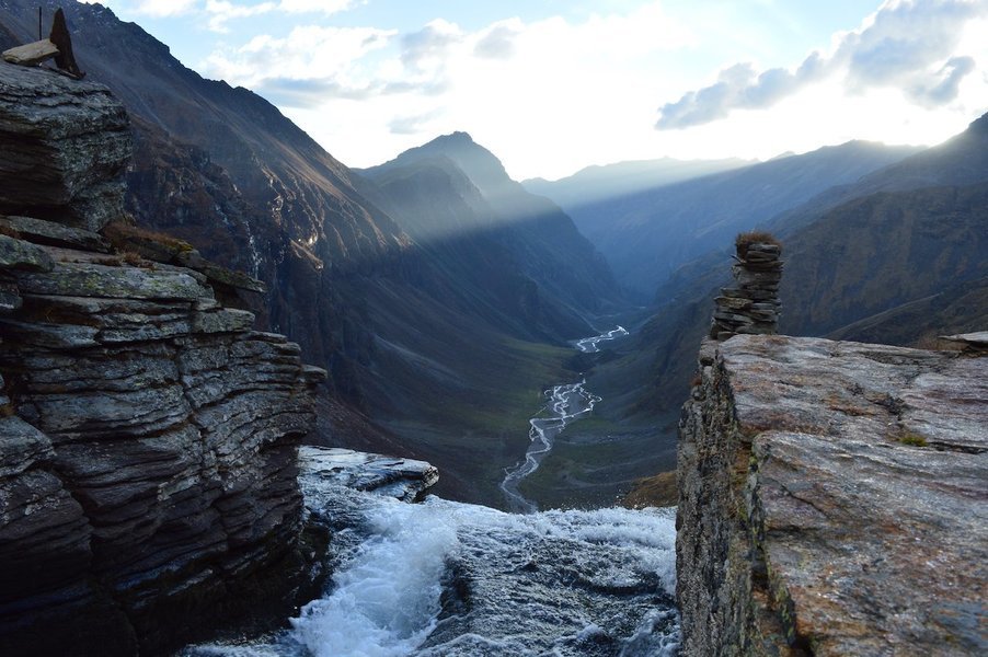
The Rupin Pass trek is a journey of discovery, full of surprises, starting with the picturesque hanging village of Jakha on the first day. The next day brings the sudden appearance of a towering coniferous forest and, if trekking early in the season, a snow bridge, all of which are sure to leave trekkers in awe. Further surprises include the isolated Saruwas Thatch and the stunning Rupin Pass Waterfall, which plunges an astonishing 1,500 feet, exceeding all expectations.
Dhanderas Thatch boasts a perfectly shaped glacial valley with numerous waterfalls cascading down, leaving observers in awe of its natural beauty. The trek continues to the expansive snowfields of Rata Pheri, offering an unexpected alpine experience. Trekkers will be captivated by the stunning Rupin Gully panorama and the thrilling adventure of the daunting climb to Rupin Pass. The descent to the Ronti Gad campsite offers new surprises, ensuring that trekkers remain captivated until their journey ends in Sangla.
The Rupin Pass trek is renowned as one of India’s top treks due to its unique blend of high-altitude adventure and ever-changing scenery, making it a must-visit for trekking enthusiasts.
The Rupin Pass trek is an exhilarating high-altitude trek that begins from Jiskun and ends at Sangla. With an altitude of 15,250 feet and a total trekking distance of 40.2 kilometres, it is considered a moderate-difficult trek that requires good physical fitness and can be completed in 7 days. The best seasons for this trek are the 1st week of May to June end and mid-September to mid-October. During May and June, temperatures range from 15° to 20° C during the day and 4° to 7° C at night, while in September and October, temperatures range from 13° to 20° C during the day and 2° to 7° C at night. From early July to mid-September, snow is present in the upper regions from May to October
Included and Excluded
- Accommodation: 02 Nights Accommodation in Bawta/Jiskun and Jakha Village in Homestay on triple sharing room. 04 Nights Accommodation in trekking tents on triple sharing basis.
- Meals: Basic Indian Vegetarian Meals starting with Dinner on Day 01 and ending with Breakfast on Day 07 (03 meals a day).
- Trekking Guide: 01 Certified Trekking Guide and Certified Trek Leader along with a local guide during the trek.
- Trekking Crew: Trekking crew includes cooks and helpers.
- Permits and Permissions: All Trekking and Camping Permits and Permissions are included.
- Local Transportation: Transportation from Shimla to Bawta/Jiskun and Sangla to Shimla.
- Camping Equipment: All necessary camping equipment is provided, including Sleeping Tents, Dining Tents, Kitchen Tents, Toilet Tents, Sleeping Bags (you may also carry your own sleeping bags for comfort), and Sleeping Mattress.
- GST (5%) on Invoice Amount:
- Travel/Health Insurance:
- Meals/Snacks/Beverages during the trip:
- Airfare/Train Fare:
- Medical Expenses:
- Personal Expenses:
- Additional Costs:
- Backpack Offloading Charges:
Highlights of the Tour
- Witness the spectacular views of the Kinnaur Kailash range.
- Experience the breathtaking view of the Rupin River and Alpine meadows.
- Discover the meadows of marigold flowers.
- Marvel at the flabbergasting view of the Dhauladar range
Itinerary
Altitude: 7,700 feet The drive is about 205km that will take almost 10 hours All the trekkers will be picked up from Shimla old bus stand at 06:00 am in a four-wheeler like bolero, travller or any other vehicle’s Only dinner is included, not the breakfast and lunch Night stay will be organized in the Home Stay, Guest House Last Network till Chanshal Pass, Jiskun & Jakha Last ATM Rorhu The weather will be cold on the first day of your journey to Jiskun by vehicle. Be prepared to see stunning views of nature and hills that amaze you. If you love nature, have your camera ready, as the scenic views are indescribable. You will travel to Jiskun through Rorhu, a town on the river Pabbar, located approximately 110km from Shimla, Himachal Pradesh. You will cross the Chaaisheel Valley to Rupin Pass basecamp – Jiskun. Instead of the traditional Rupin Pass trek itinerary from Dehradun to Dhaula, the road through Chainsheel Valley has improved, so we prefer driving from Shimla to Bawta. As the road from Rorhu splits into two routes, the first road leads to Janglik, the base camp for the Buran Ghati trek, while the second goes to Jiskun, the base camp for Rupin Pass. The drive will be through the beautiful and scenic Chainsheel Valley. After the long 8-10 hour journey, you will be served delicious meals to regain strength.
Altitude: 8,700 ft It is a 4 km trek with a difficult level of ascent and steep climb Within 04 hours, you will reach Jakha from Bawta Hot lunch at the campsite and tea & Maggi stalls are available on the way Moderate climb till Jiskun and then descent till wooden bridge and zig-zag trail till Jakha Selwan Khad is the last water point Night in a homestay or tents Embark on a 4-kilometre journey to Jakha, the final and highest village on the Rupin Pass trek. Leaving Jiskun, the path descends through a dense forest of towering deodars and walnut trees, eventually leading to a captivating, shadowy gorge in the mountain. The upper reaches of this gorge are inaccessible to humans, creating an air of mystery. You’ll glimpse the remnants of an old wooden bridge almost hidden by vegetation. Below, you’ll traverse the new wooden bridge and gaze upward at the eerie, rock-cut path that seems almost otherworldly. Please take a moment to appreciate the marvel of its construction. The subsequent hour-long ascent to Jakha unfolds on one of the most magnificent trekking trails. The scenery constantly changes as the path zigzags upward along the ridgeline, leading through a mesmerizing mixed forest accompanied by bird songs. Be cautious to avoid taking a diverging trail to the left, which leads to the village of Dhara, situated above Jakha. Instead, veer to the right to stay on course. The village of Jakha is deeply rooted in the principles of Satsang, and as such, it is a meat-free zone. The campsite, situated just above the town, doubles as a playground for the local children. Alternatively, the school courtyard can also serve as a campsite. Jakha is the final opportunity to restock supplies and seek out porters if needed, as the next few days of the trek will be largely solitary, except for occasional encounters with shepherds tending to their livestock. This isolation persists until Sangla’s arrival.
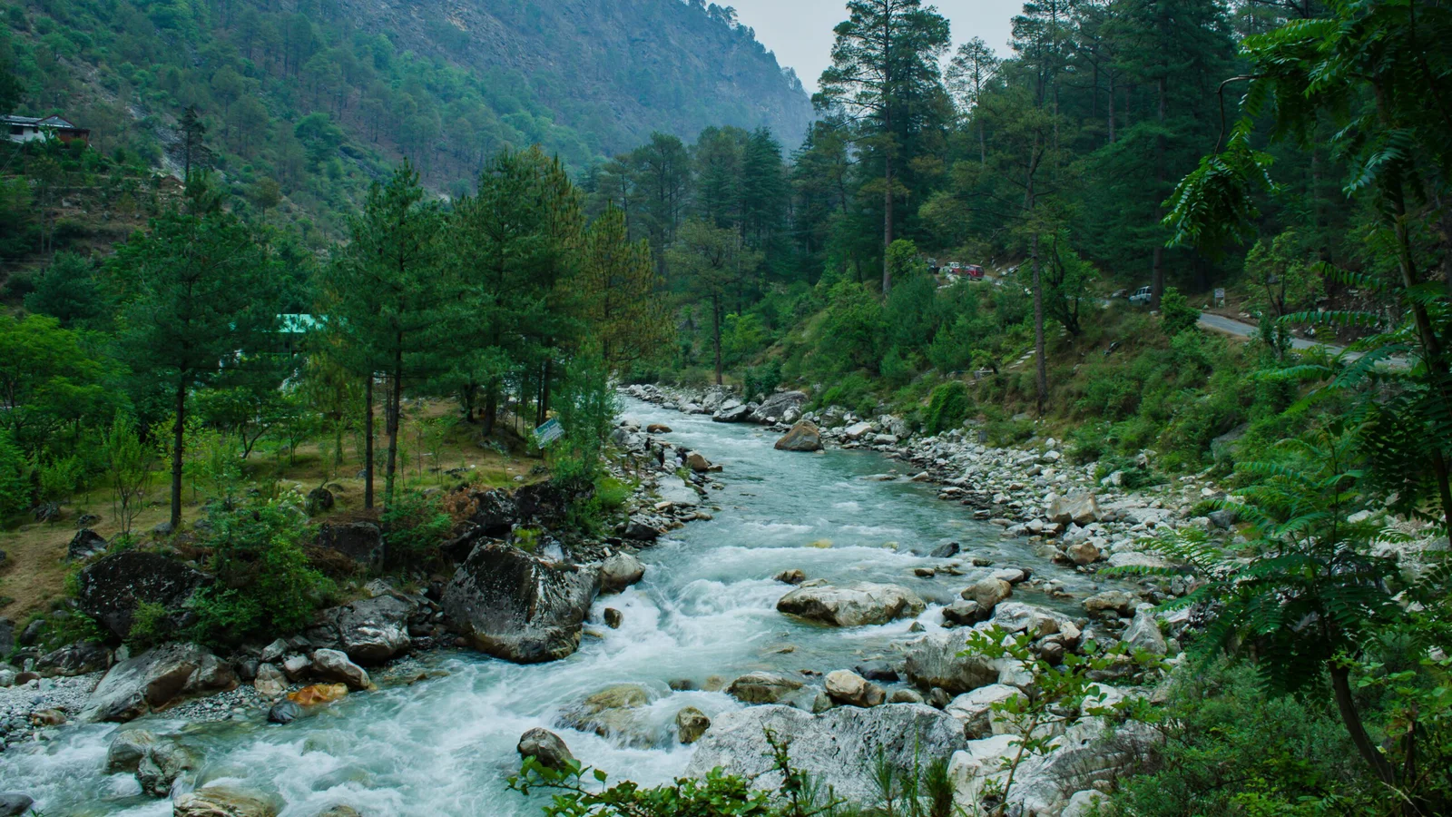
Altitude: 11,680 ft It is an 7 kms long trek that will take 4-6 hours. Long walk but easy and most walk is along the river so you will enjoy Bottles can be filled from the river Snow bridges and wildflowers Delicious packed lunch will be provided Stay in a tent on twin sharing basis The trail beyond Jakha leads to a stunning coniferous woodland, where majestic blue pines and occasional maple trees create an unspoiled and serene environment. As you descend, you’ll encounter a surprising expanse of snow forming a natural bridge over the Rupin River, providing a breathtaking experience. In extreme summer heat, the snow bridge may become impassable due to melting, but an alternative route is available, including a sturdy wooden bridge that spans the river. The path narrows along a small track, eventually leading to a wooden bridge and the inaugural expanse of Udakanal’s lush grasslands. The landscape unfolds with a distinct character, frequently paralleling the winding route of the Rupin River, which is fed by numerous small streams cascading down from the mountain’s upper slopes. After a 90-minute hike, the path ascends towards a dense stand of trees, passing by a picturesque spot known as Burans Kandi. Downstream, the Rupin River flows with turbulent waters while massive swaths of snow cling to the mountain gullies. As you ascend, you’ll find yourself enveloped in a stunning sea of Rhododendrons, leading to a more extensive clearing where a charming little island covered in a vibrant carpet of green grass awaits, nestled in a meadow with the Rupin River on your left.
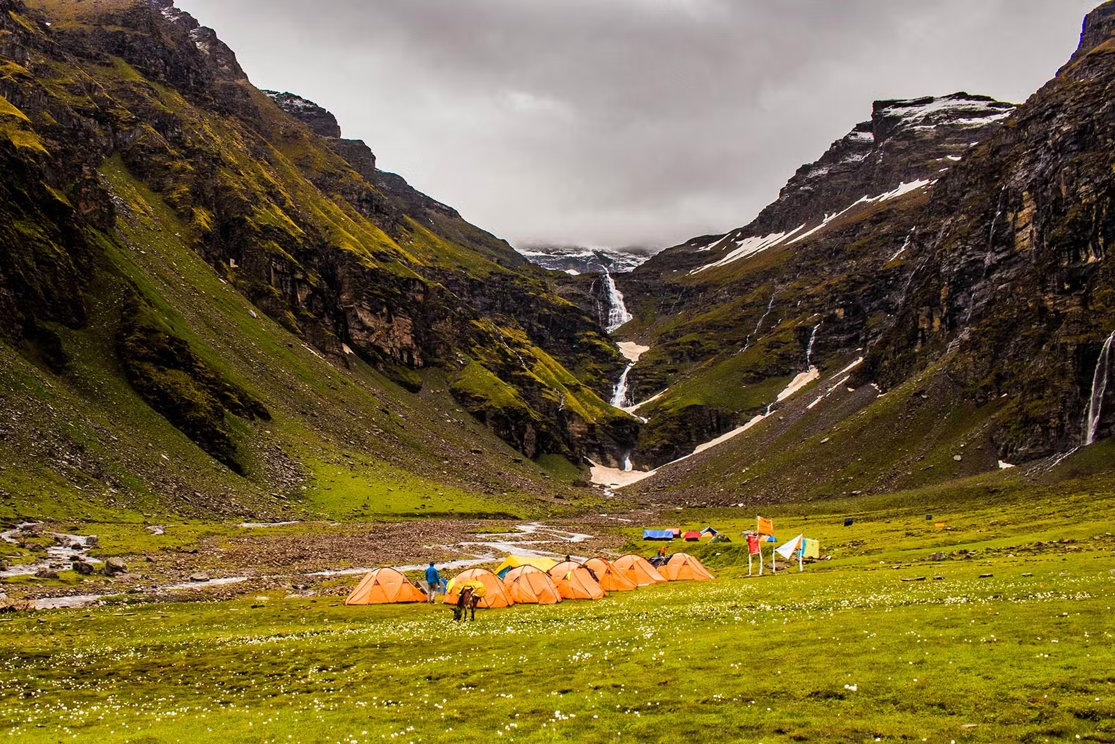
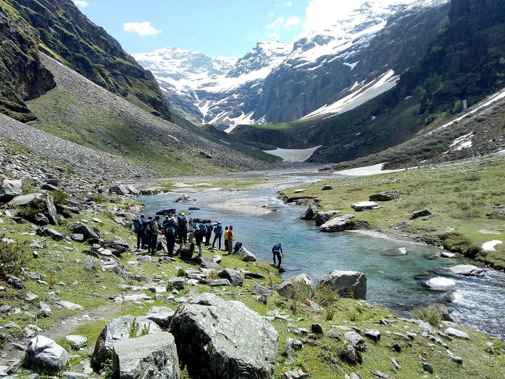
Consider exploring the following half-day trekking route from Saruwas Thatch to Danderas Thatch. This 2-3 hour journey involves an elevation change from 10,770 feet to a peak of 11,700 feet and is rated as simple, making it the easiest day of the entire trek. This visually pleasing trek takes you through petite grassy areas that burst with vibrant blooms in the warmer months and a kaleidoscope of colours in the fall. The journey concludes at the renowned Dhanderas Thatch or Lower Waterfall camping spot, positioned at the foot of the 1,490-ft Rupin Waterfall. As you stand at the edge of the U-shaped valley at Saruwas Thatch, prepare to be inspired by a breathtaking sight: countless silvery waterfalls cascading down the valley’s slopes, merging with the Rupin River. In contrast, expansive emerald meadows adorned with vibrant yellow marigolds stretch before you. The Rupin River flows gently through the rolling hills, creating a picturesque landscape enhanced by scattered patches of snow. Descending into the valley filled with yellow marigolds. Your first challenge awaits: a snow bridge spanning the Rupin River. Brace yourself for a steeper incline than expected as you carefully ascend the snow bridge. Despite the short-lived steep section, crossing the snow bridge is an exhilarating experience, leading you swiftly to the left side of the Rupin. The trail winds upward through the vibrant meadows, where you will encounter small, babbling streams and colourful wildflowers. The serene Rupin River flows alongside, its crystal-clear waters glistening with a hint of icy blue. Continuing along the riverbank, you will come across a broad riverbed and a massive snow bridge, which marks the starting ascent to a high plateau. The ascent offers slow suspense, gradually building anticipation for the next breathtaking vista. As you reach the stunning meadow, you may even be tempted to pitch your tent in this captivating Himalayan campsite. Nestled in the valley’s heart, you will be surrounded by natural wonders, including a three-tiered waterfall, the majestic Dhauladar Range, and snow-capped valley walls punctuated by numerous waterfalls. The best time to visit is during the summer months when the weather is mild and the meadows are in full bloom. Rest assured, water will not be a concern as clear icy streams flow nearby in every direction. Set up your tent and immerse yourself in the beautiful natural surroundings at Dhanderasatch, which features a stunning landscaped lawn.
Altitude: 13,120 ft. It is a picturesque day of the trek with 3.5km, 305 hours You can refill your bottle from small streams Moderate level of ascent along with complicated climbing trail around the snow patches Do not get on the snow patch directly Hot lunch at the campsite As you embark on your journey towards the ‘Upper Waterfall,’ you’ll be greeted by the vibrant yellow blooms of Marigold adorning the landscape, offering a feast for the eyes. We will provide technical equipment and impart essential knowledge about altitude-related precautions to ensure your safety. Additionally, we will conduct a brief training session to equip you with the skills required for snow trekking, including sidestepping, sliding on snow, and cutting through the snow. Your initial destination will be the lower waterfall, where you will navigate through ice using an ice axe. Upon reaching the lower waterfall, you’ll encounter a breathtaking snow bridge spanning the Rupin River, following several challenging climbs. Upon reaching this bridge, you’ll be greeted by a captivating environment that will invigorate you and leave you in awe. Despite a steep ascent, upon reaching the upper waterfall camp at an altitude of 13,100 ft., you’ll realize that your efforts were worthwhile. Take a moment to absorb the panoramic views from this camp, immerse yourself in the unique beauty, and prepare to experience a profound sense of fulfilment. This experience will instil in you the confidence and strength to continue your trek towards the Rupin Pass the following day. While day six promises adventure, the subsequent day will be more exhilarating and filled with anticipation. Once you cross the bridge, you can look forward to unwinding and savouring your time at the campsite before indulging in a well-deserved dinner.
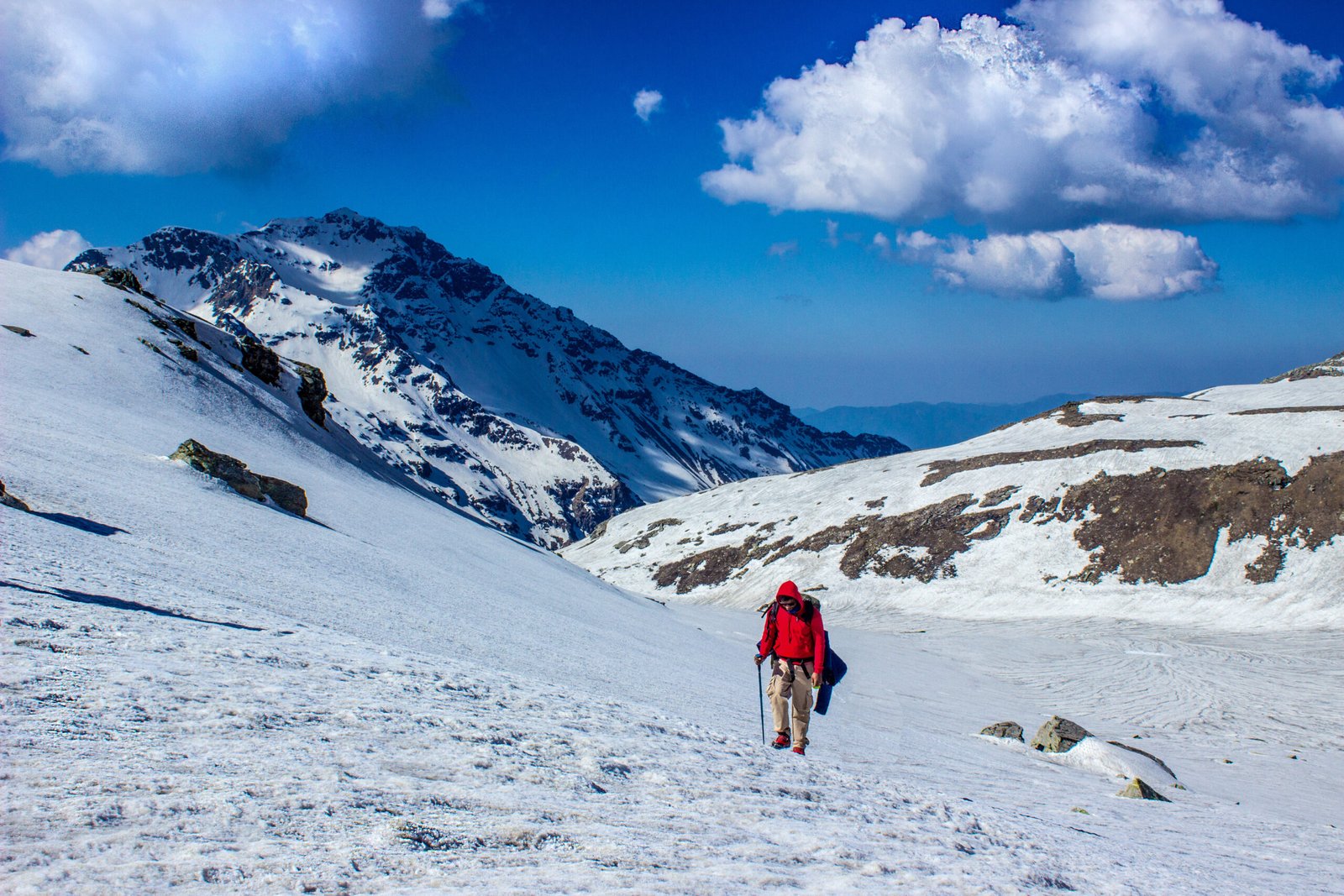
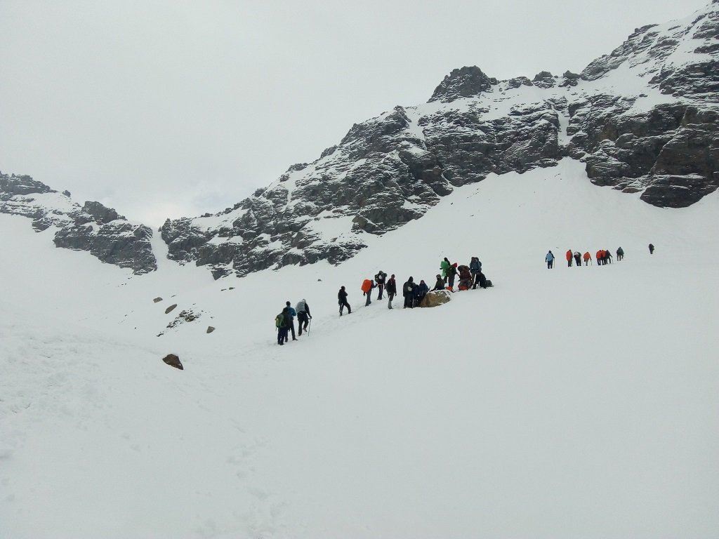
Altitude: 13, 420 ft It is a 9km trek and most exciting day where you will pass through a tough level of ascent Till the pass, there is a steep ascent and then steep descend You will take almost 10 hours trekking By 04:30 am, leave the camp and carry your hot water from camp as water sources are limited Packed lunch will be provided In the late evening, we will be reaching Ronti gad On day 6 of the trek, it’s essential to wake up early as it will be a long day of trekking. After breakfast, the trek to Rupin Pass, which stands at 4,650 meters, will begin. It’s crucial to carry all necessary trekking equipment for a safe journey. The trek includes a steep ascent to Rati Pheri and a break to appreciate the remarkable changes in nature. The trail is covered in snow, offering a breathtaking view of Rupin Pass. Trekking through rocky terrain requires caution due to loose rocks and potential falling stones. Climbing individually is recommended to avoid difficulties. Despite the tiring ascent, reaching the summit will be uplifting, offering colourful flags and a stunning view of the Dhauladhar Range. Descending from the summit is fun and leads to the pastures of Ronti Gad, which are distinct from previous sights on the trek. Ronti Gad features snow-covered mountains and captivating meadows. After a long and eventful day, resting in tents will be necessary.
Altitude: 8,800 Last day of trekking, you will trek for 12 km Till Sangla, moderate level of descent Several water points on the way You will reach Sangla by 1-2 pm in the afternoon cab will leave from Sangla at 3 pm and reach Shimla by 2 am in the night Drive back to Shimla (9-10 hours) Make your bookings for a hotel in Shimla accordingly The trek to Sangla offers a diverse and rewarding experience, with shifting landscapes and stunning views of the Kinner Kailash range and Baspa Valley. Starting the morning at a relaxed pace is recommended, as the descent involves quickly changing altitudes and can become quite hot near Sangla, especially compared to the cold elevation of the Rupin Pass. The shepherd’s route from the campsite descends towards the valley, where you may encounter shepherds and their herds. After an hour and a half and a descent of more than 1,500 feet, the path opens to a breathtaking view of the valley above the Rukti Gad, with the snow-covered Nalgan pass visible on the right. As you descend, the meadows cover the mountainside, hiding the snow from view, and the majestic Kinner Kailash range looms ahead. The sight is awe-inspiring and leaves trekkers rooted to the spot. The Sangla Kanda Lake and a small village become visible as you descend towards the town, offering a welcome rest stop with friendly locals and hot tea. Multiple pathways radiate from Sangla Kanda towards Sangla, and following any route veering to the right will eventually lead you to the primary route, hugging the lake’s perimeter. The landscape transitions from dense foliage to a forest of blue pines as you continue towards Sangla, walking alongside the Rukti Gad river. The path eventually widens and descends, leading to Sangla, where charming wooden cottages and terraced fields come into view. The dense forest of blue pine trees gives way to lush apple groves, marking a return to civilization. After crossing the Baspa River bridge, a challenging 20-minute ascent leads to the paved road in Sangla. Multiple concrete pathways guide you to the main road, and you can inquire about the location of the bus station, which is marked with painted signs. Restaurants and accommodations are available in Sangla, offering affordable bed and bedding options. The final bus bound for Shimla departs at 5:00 pm and arrives in Shimla at 3:00 am the next day.
Location Map
Frequently Asked & Question
Book Your Tour
Reserve your ideal trip early for a hassle-free trip; secure comfort and convenience!








Leave a comment: